This is one of the fastest parts of Gauja, it is suitable for one day trips (the river fall is around 5 m, the trip takes around 4-5 hours). The route includes beautiful sights to see from the boat.
This route starts from campsite “Jeņču laivas” (located in the street, called “Gaujas iela 90a”).More This is one of the fastest parts of Gauja, it is suitable for one day trips (the river fall is around 5 m, the trip takes around 4-5 hours). The route includes beautiful sights to see from the boat.
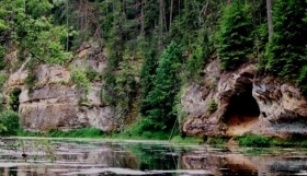
This route starts from campsite “Jeņču laivas” (located in the street, called “Gaujas iela 90a”).More This is a relatively peaceful 38 km long route which is suitable for two day trip with several sights to see. It leads through Gauja National Park Latvia and includes beautiful views and many cliffs to see.More This is one of the most beautiful route in Gauja with several sights to see. The starting point is easily accesible by cars, so many water tourists use it as a starting or ending point for trips.More This is one of the most beautiful route in Gauja with several sights to see. The starting point is easily accesible by cars, so many water tourists use it as a starting or ending point for trips.
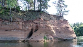
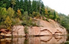
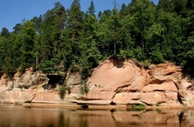
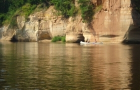
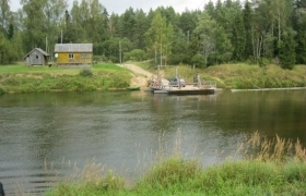
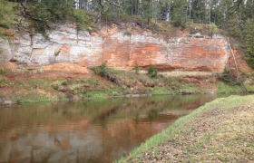
Approximately 1,5 km from „Jāņarāmis” there are „Ramatu” cliffs- one of the most impressive sandstone cliffs in Gauja National Park Latvia. Note- cliffs are not suitable for trekking.More This is easy one day trip on the beautiful river Gauja. Route length is 24 km, the route starts near Līgatne Ferry which is the only remaining ferry across the Gauja river. In the 17th century there were nine ferries across the Gauja River to ensure convenient communication with Estonia and Russia.More Salaca river is the fifth longest river in Latvia and it is 95 km long. From Mazsalaca is starting one of the most enjoyable parts of the Salaca river. The river calmly flows along the Valtenberģi manor park, rocks, caves, through Skaņaiskalns park where can be seen sightseeing objects made by nature and also by humans – ‘’Skābumbaļla’’, ‘’Velna Cave’’, ‘’Vilkači pine’’, ‘’Love bridge’’ and ‘’Dreams’ ladders’’ are just a part of them. It is interesting to go ashore and to try unique echo near Skaņaiskalns rock.More